Curious what's new with Apple Maps? Stay up-to-date on the latest news here!
Lost your way? Don't worry — Apple has a Maps app built right in, so you'll never get off-track again. However, the world is ever-changing, and as a result, so is Apple Maps. Because the app is often getting bigger and better, we've created a one-stop shop for the latest and greatest Maps news. Bookmark and check back regularly for updates!
If you want to learn how to use Apple Maps to its fullest potential, check out our Ultimate Guide to the Maps app.
What's new with Apple Maps?
Check back here for the latest updates in Maps news.
March 29, 2018: Find gender-neutral restrooms using Maps!
If you're not already checking the "Useful to Know" section when you search a location in Maps, you absolutely should be. It's full of handy information that can help you plan your day out and about, especially if you're traveling or visiting somewhere new. It includes whether or not a place accepts Apple Pay, if you can make reservations there, if it's kid-friendly, and, most importantly to some, whether or not it has gender-neutral restrooms.
@Apple Apple Maps now shows if a business has gender neutral bathrooms! This is such a win and such a great move on Apple’s end. Thank you @tim_cook @9to5mac @reneritchie @iMore pic.twitter.com/YEzkshgWW4
— Kyle Patrick (@kyleurb) March 29, 2018
To view the "Useful to Know" section, all you need to do is do a quick search for whatever establishment you're curious about, then tap on it in the suggestions that appear below your map. You may need to scroll down a bit to see it — it's underneath the location's phone number.
Though there are already dedicated apps out there for finding gender neutral restrooms for transgender and gender-nonconforming individuals — the incredible Refuge Restrooms comes to mind — it's really heartening to see this information being displayed in the native Maps app. And yes, I hear what you're saying: Shouldn't every public place have a gender neutral restroom option to provide a safe and welcoming space for everyone, regardless of how they identify? Absolutely yes. However, until that day comes, it's nice to know what to expect when you're going out for drinks with your friends or taking your family for ice cream.
March 12, 2018: Apple Maps will now show you bike-sharing stations nearby
Looking for an alternative form of public transit that doubles as a workout? If you don't have a ride of your own, you'll now be able to view nearby places in your city where you can rent bikes within the Maps app so you can get where you need to go.
According to a report by TechCrunch, Apple has signed a partnership with public transit data company Ito World, integrating bike-sharing service data into Apple Maps in more than 175 cities across 36 countries.
The feature is currently live and incredibly easy to use. All you need to do is search "Bike Sharing" in the search bar that appears when you launch the Maps app. Or, if you already use bike-sharing regularly, you can type in the name of your favorite service instead, and Maps will tell you if there are any stations nearby. It will also provide contact information for the service.
Though Apple had already added some bike-sharing services to maps in a handful of cities prior to now, integrating Ito World's existing bike-sharing data allowed Apple to make the feature available more quickly than doing all the collection in-house. And, as TechCrunch notes, "Ito World has worked with dozens of companies to license and normalize bike-sharing data. This way, Apple only has to integrate one data model to support hundreds of bike-sharing services."
Unfortunately, as TechCrunch also mentions, Maps doesn't currently show how many bikes there actually are at a station or if there are any available bike docks. Hopefully that feature will be added soon, as more specifically-dedicated bike-sharing apps already have it.
For a full list of supported services, you can check out TechCrunch's article here.
December 14, 2017: Apple Maps brings indoor maps to 30 additional airports
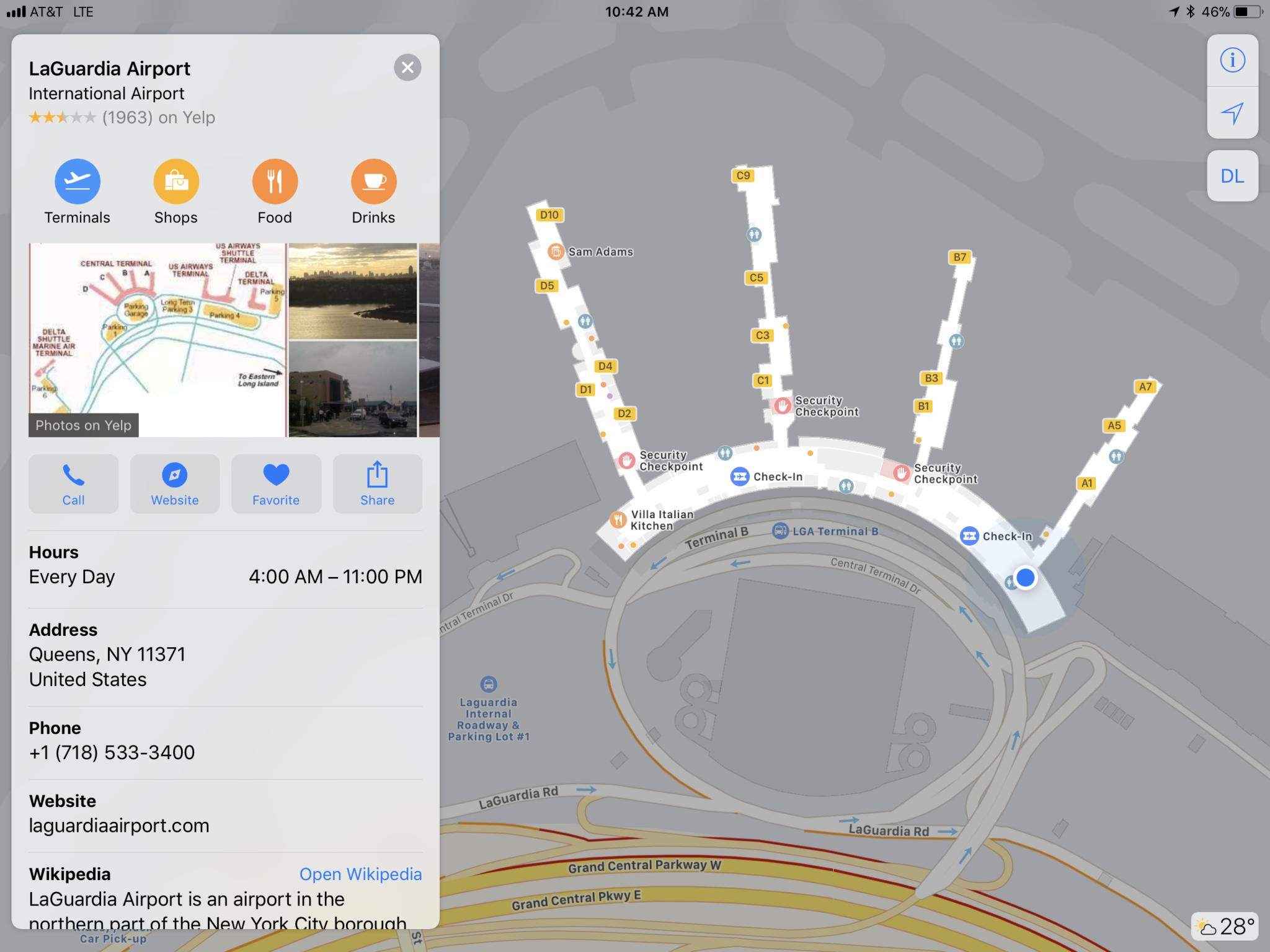
Apple announced indoor maps for places like airports and shopping malls as part of iOS 11 and the company has just now expanded the feature to include 30 more airports in the U.S. and around the world.
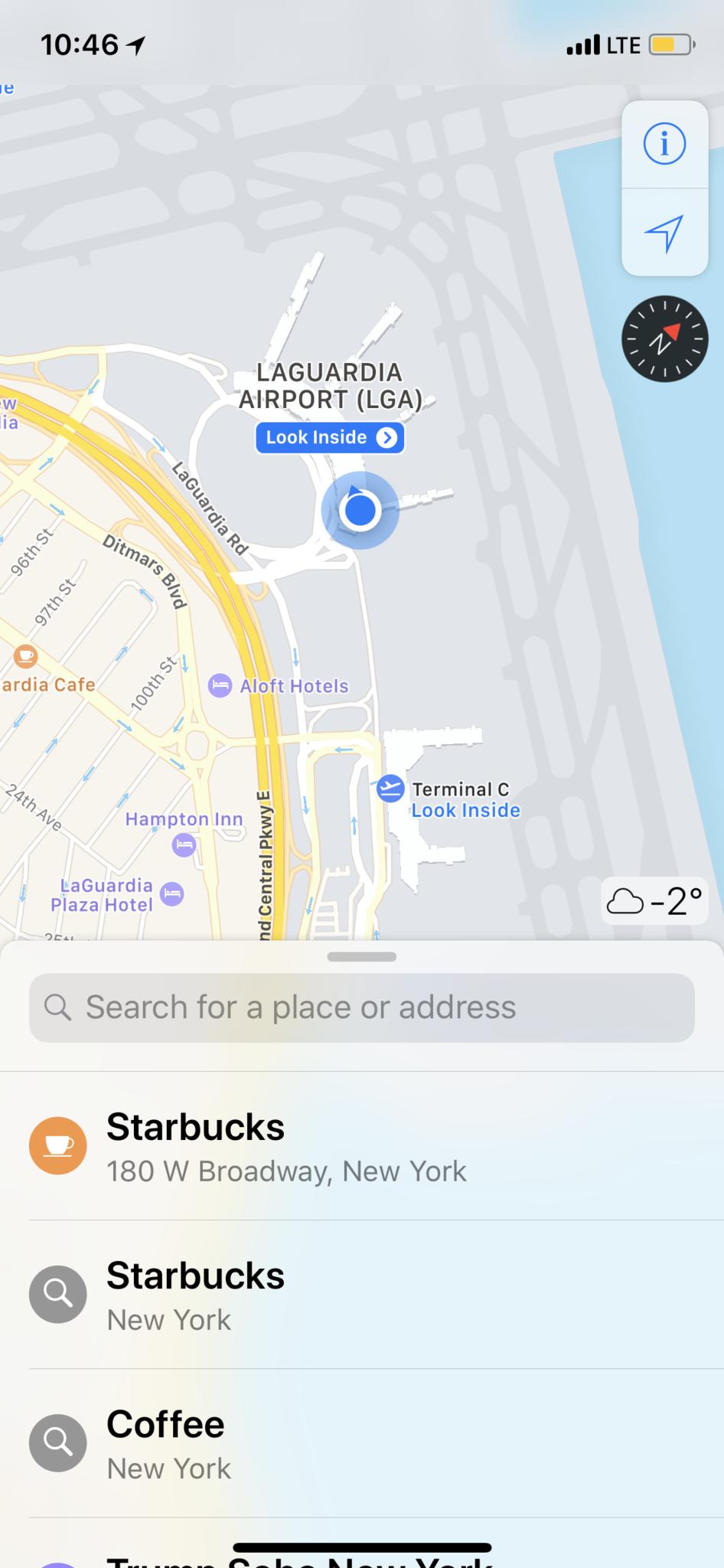
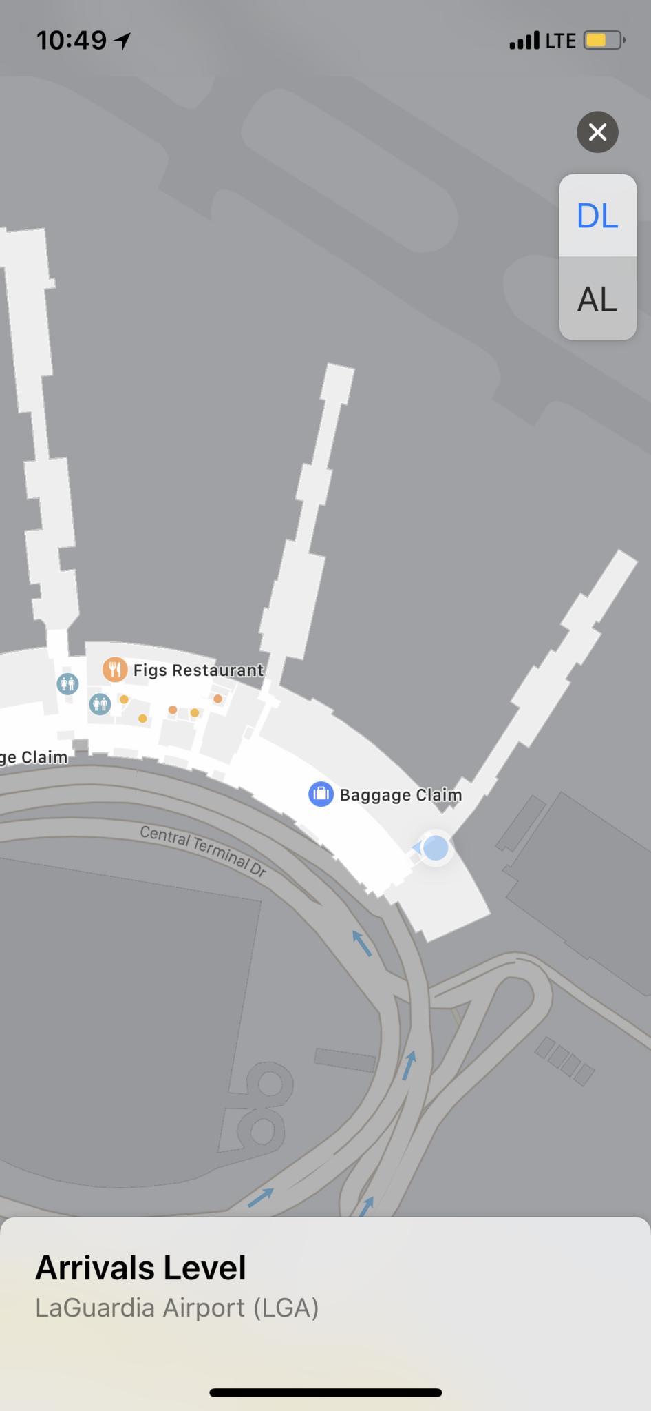
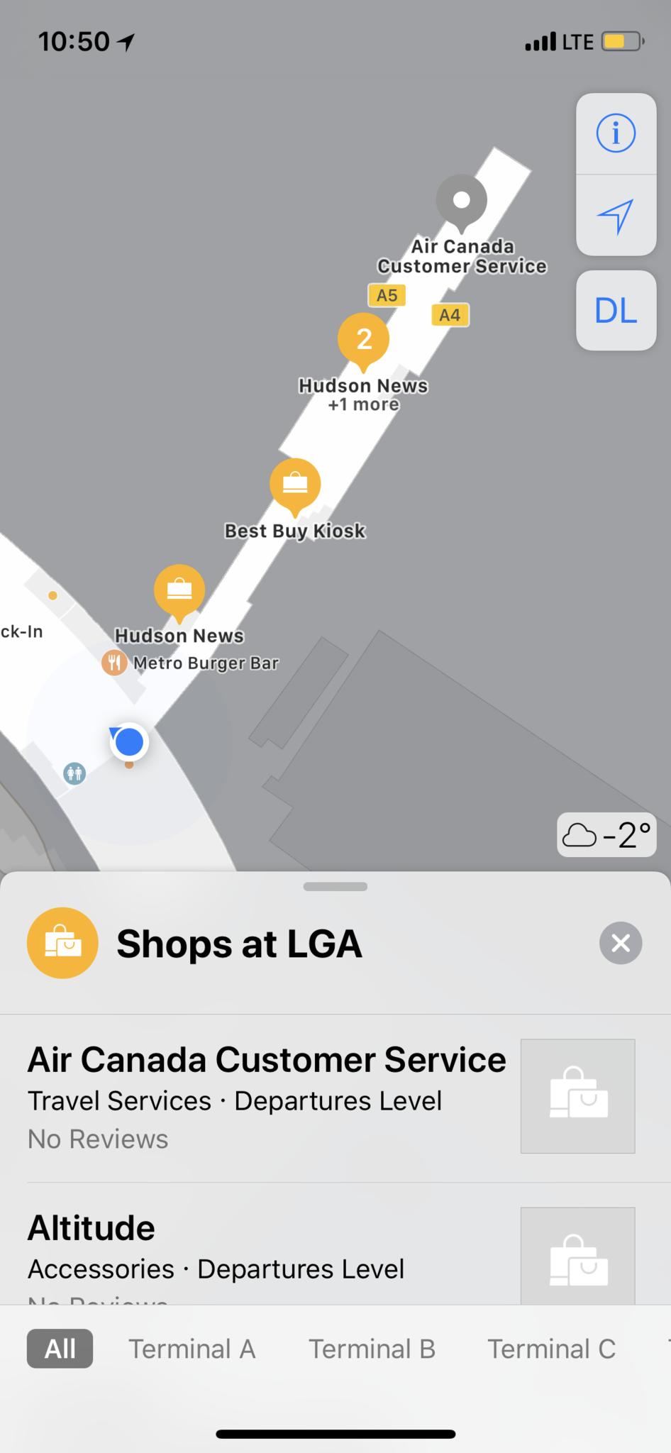
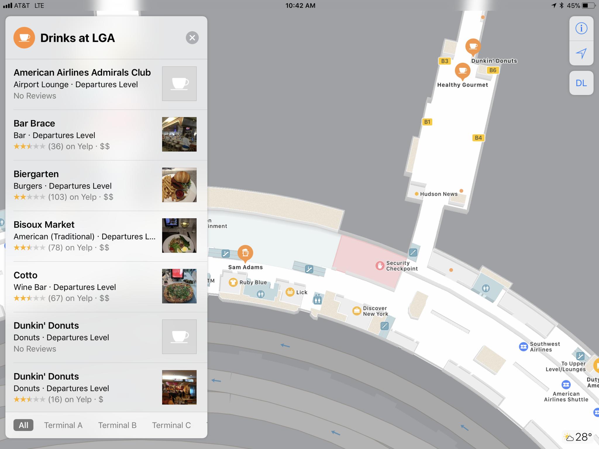
With indoor maps, you can see things like security checkpoints, food courts, and most importantly to me — coffee shops! The detail level is great, as is the seamless way you can zoom out from regular maps and into the detail view inside.
The 30 new airports coming online today include:
- Amsterdam Airport Schiphol AMS
- Baltimore/Washington International Thurgood Marshall Airport BWI
- Berlin Tegel Airport TXL
- Berlin Schönefeld Airport SXF
- Chicago O'Hare International Airport ORD
- Chicago Midway International Airport MDW
- Denver International Airport DEN
- Detroit Metropolitan Wayne County Airport DTW
- Edmonton International Airport YEG
- Geneva Airport GVA
- Hong Kong International Airport HKG
- Houston George Bush Intercontinental Airport IAH
- Houston William P. Hobby Airport HOU
- Indianapolis International Airport IND
- Jacksonville International Airport JAX
- Las Vegas McCarran International Airport LAS
- London Heathrow Airport LHR
- London Gatwick Airport LGW
- Los Angeles International Airport LAX
- Orange County John Wayne Airport SNA
- Miami International Airport MIA
- Minneapolis–Saint Paul International Airport MSP
- Nashville International Airport BNA
- New York John F. Kennedy International Airport JFK
- New York LaGuardia Airport LGA
- Newark Liberty International Airport EWR
- Oakland International Airport OAK
- Philadelphia International Airport PHL
- Pittsburgh International Airport PIT
- Portland International Airport PDX
- San Diego International Airport SAN
- San Jose Norman Y. Mineta International Airport SJC
- Seattle–Tacoma International Airport SEA
- Toronto Pearson International Airport YYZ
- Vancouver International Airport YVR
Sadly, my local Trudeau airport in Montreal (YUL) hasn't been added yet, but I just happen to be at LGA right now and, in my quick tests, it's working a treat. You can tap to switch between departure and arrival levels, for example, and use nearby to find shops, snacks, and more.
Airports, especially when you're rushing for flights or facing weather delays, can be beyond stressful. Indoor maps take the edge off that stress and help you not only find where you need to go, but places you want to check out while you're waiting to go.
Apple put in a lot of extra effort as well, traversing every airport, making sure dead zones were covered and walls and doors were accurately placed.
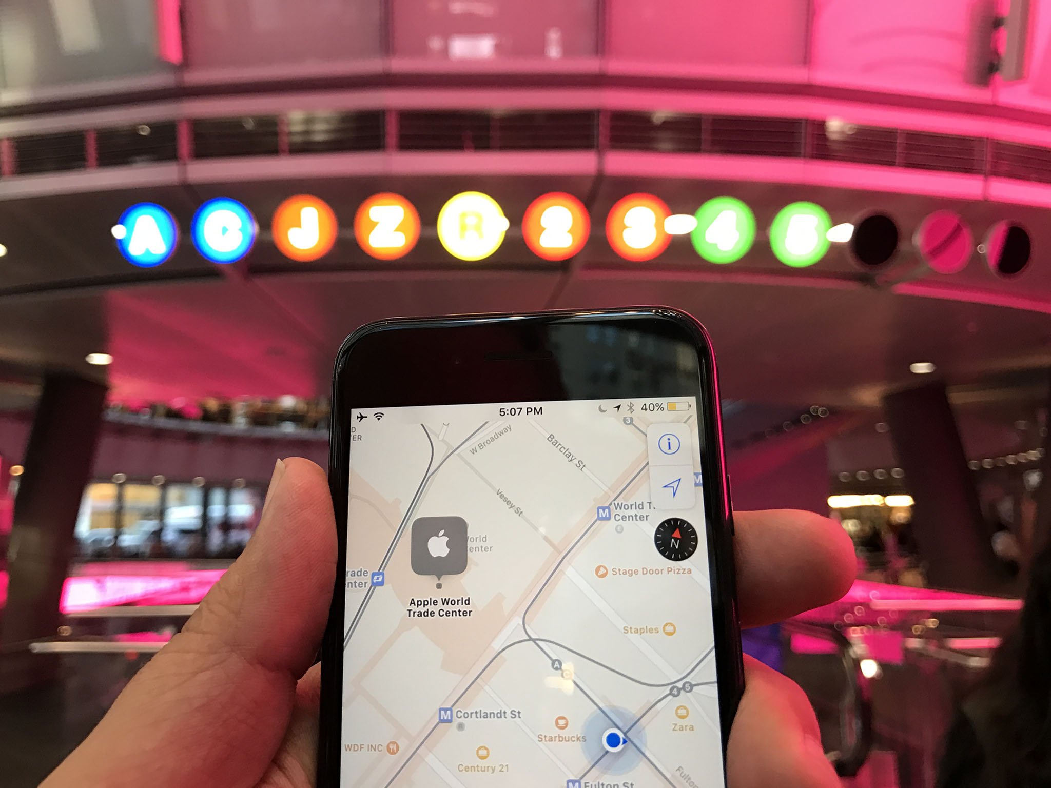
When you put it together with indoor location, which makes sure you know exactly where you are at all times, and it's beyond impressive. (Especially when you consider all these international airports are so different.)
If you live in a city where Apple's indoor maps for airports just went live, check 'em out and let us know what you think.
September 13, 2016: Say hello to Maps for iOS 10
Apple Maps has lagged behind its competitors for a few years — in part because Apple was late to the game. But over the last year, it's become a more stable, usable service. iOS 10 continues that trend, bringing huge (and much-needed) software and server-side improvements to Apple's mapping application.
No, it's still not perfect: In driving mode, it continues to struggle with traffic estimations and offering up the best alternate routes. But for local driving, it's gotten leaps and bounds better.
The new look
Apple Maps has embraced the San Francisco bold look head-on, with clear, readable maps labels, bright colors, and crisp text. The top and bottom navigational bars have disappeared entirely, replaced by contextual cards and a small overlay for further information, GPS location, and the weather. Though you get more visual overhead as you use more complicated Maps options, the general focus seems to have been on keeping it light, clean, and understandable.
On launch, the bottom card will display a search bar along with predictive locations (based on your routine or Calendar appointments) and favorite or recent locations. As will soon become custom, you can scroll up on this card to get an expanded list, as well as full access to your Favorites list.
Tap on an address or pin, and that contextual card changes, offering you an address, estimated mileage and driving time, and — if it's a public business — Yelp-sourced information on the business's hours, photos, website, menu, and the like. (You can tap any of these to go directly to Yelp for more information.) You can even tap on yourself to either mark your current location with a pin, or share it with your friends.
Search improvements
Where Apple Maps has really branched out is in its search: Though it still pulls primarily from Yelp's database, it's become a lot easier to find and narrow down options for food, entertainment, travel, gas, and more. When you tap on the search bar, eight brightly-colored bubbles appear to whisk you off to the business of your choosing: Food, Drinks, Shopping, Travel, Services, Fun, Health, or Transport.
Tap on one bubble, and you go further down the rabbit hole into a sub-genre of options: Food, for example, offers up a Popular section, along with Restaurants, Groceries, Fast Food, Coffee Shops, Bakeries, and Desserts.
Once you pick a category, you can browse through a listing of suggested eateries or drill down further — a sliding menu along the bottom of the screen lets you select specific brands or options. (For example, tapping Bakeries in the Northeast will give you sub-options that include all nearby Dunkin Donuts, Panera Bread, Au Bon Pain, and the like.)
Adventures in directions
Let's get this out of the way: Maps's server-side directions still need some work. Over the past few months, I've been running it on all my short- and long-haul trips simultaneously with Google Maps, and while it generally keeps up quite well, there are still some holes in its computations. (Notably when traffic is involved, or trying to branch off the well-worn path through slightly more obscure street routes.) It's miles better than Maps's initial server woes, and largely only when driving routes are involved: I actually quite prefer Apple's transit data to Google Maps. But the caveat needs to be stated, and so it has been.
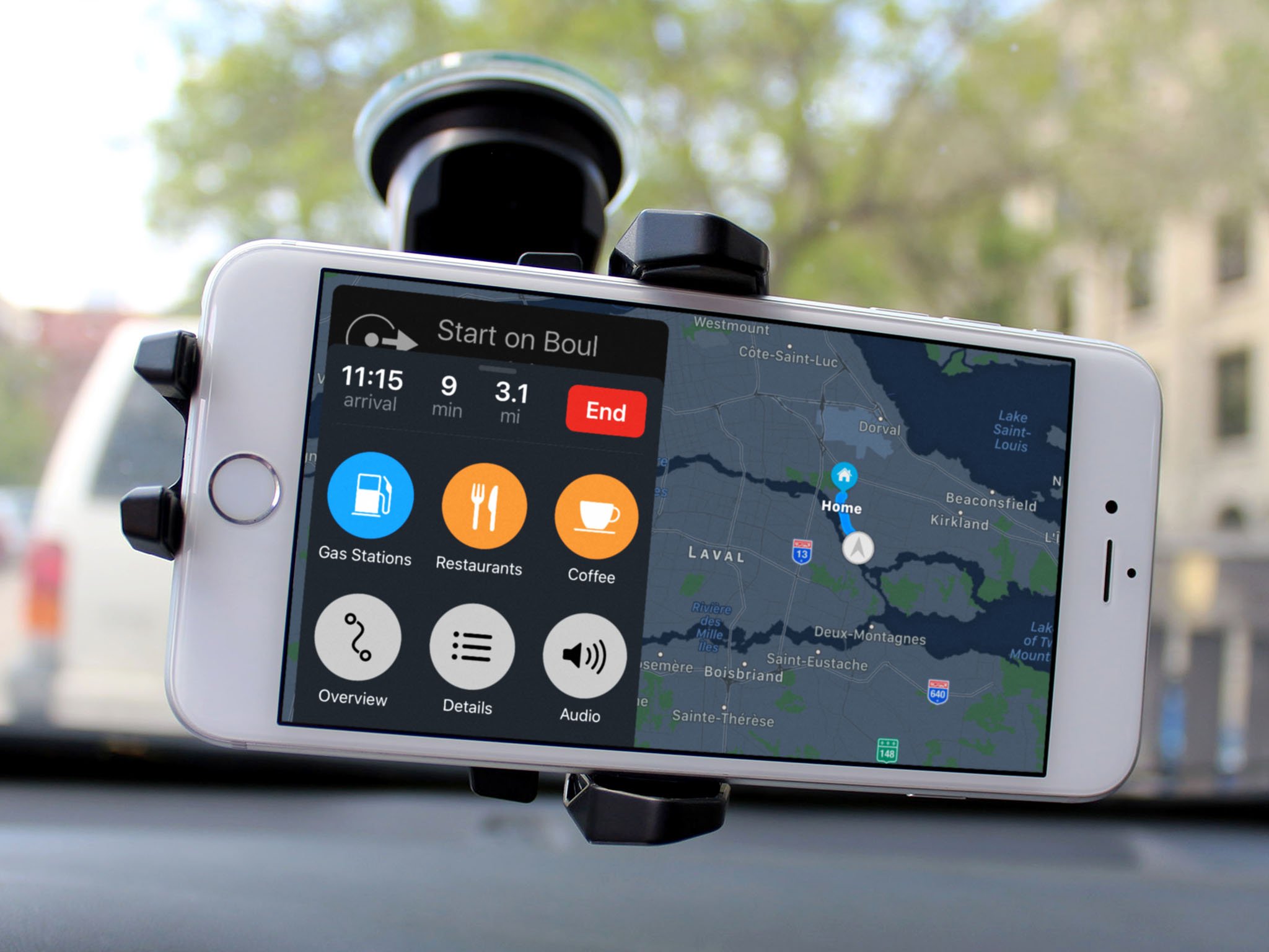
That aside, Maps now has one of the best interfaces for directions out there. The new bold, bright look is great for quick-glance information when in the car, and both Siri and large buttons help keep your attention on the road as much as possible rather than yelling at your directions-providing device. Outside the interface, Maps fixes a niggle I've had since version 1.0: It now lets you zoom to any point on the map with a multitouch pinch gesture, as well as view a full overview of the route.
When turn-by-turn is enabled, you can also search along your route for local food, gas, or coffee options by tapping a few big buttons; you can also just ask Siri "Is there a coffee place nearby?" and Maps will present options and automatically add a stop to your route if you so desire. It works just as well (if not better) than Google's implementation — having Yelp data and rankings to draw on is a welcome addition to the sometimes-stressful job of picking road trip stops.
When you're planning your routes, Maps offers multiple options, like most major mapping services; Apple has also now incorporated switches that let you avoid tolls or highways — a big deal for metropolitan folk — and transit options that let you exclude certain methods of transportation in favor of others (turning off bus routes, for example, if all you want to see are train schedules).
Hello, car
Hands down, my favorite Maps feature in iOS 10 is Apple's new "Parked Car" marker. If your vehicle has either CarPlay or Bluetooth connectivity, your iPhone will recognize where it last chatted with your car, and mark it in the Maps app. Not only that: It'll tell you when you last parked (so that you can accurately monitor meters), and offers a notes field where you can add a photo (of your parking garage number) or different notes. I have used this feature pretty much daily since installing iOS 10, and my forgetful parking lot self can't really imagine life without it.
Beyond the Maps app
Maps is one of Apple's test-case apps that supports third-party embedded extensions: Though not as expansive as, say, Messages, Maps will let you book reservations and rideshares directly through the app — even from the directions screen. It's clearly a very limited concept at launch (there aren't that many rideshare services, period), but as with Apple's other embedded app experiments, this could snowball very quickly if it proves successful. I'd love to be able to embed Carrot Weather in place of the fixed weather widget, for example.
Questions?
We'll have a lot more information and how-tos about Maps in the days to come, but let me know if you have any questions about these features; I'm happy to answer.
Maps for iPhone and iPad
- What's new in the Maps app
- How to find locations and get directions with Maps
- How to share location and directions with Maps
- How to delete your search history and prior destinations in Maps
- How to use Siri with Maps
- How to enable and use Maps extensions
- Best Maps app extensions
- How to change settings for Maps
- How to report a problem in Maps
- How to use Maps with CarPlay
from iMore - The #1 iPhone, iPad, and iPod touch blog https://ift.tt/2xJaZHA


Comments
Post a Comment